
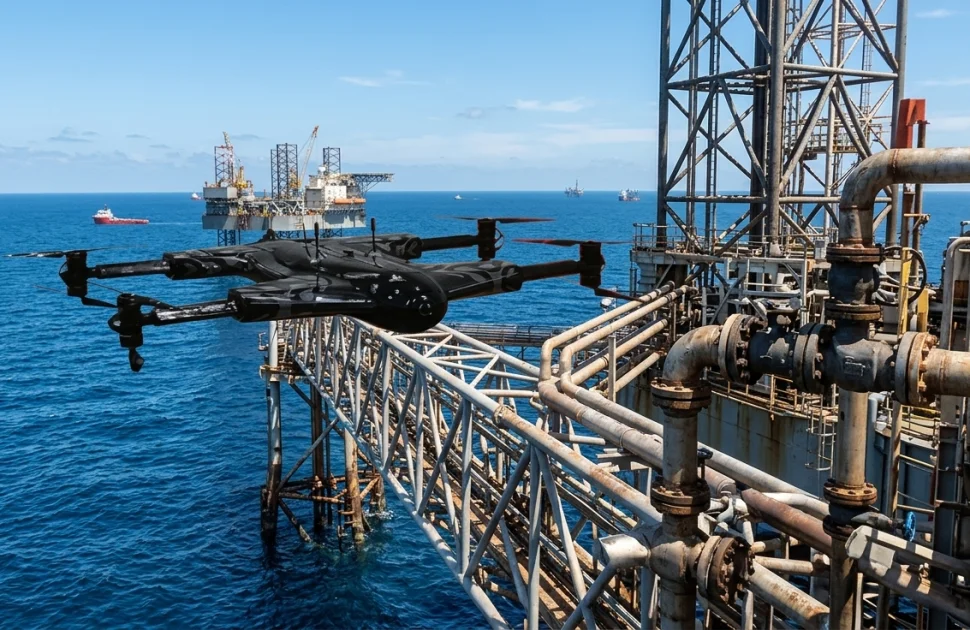
Offshore oil and gas facilities operate in demanding environments where saltwater, wind, waves, vibration and continuous production place infrastructure under constant stress. Yet reaching every component can be difficult. Conventional methods may involve scaffolding, rope access, workboats or elevated work platforms, each requiring planning, personnel and suitable weather conditions.
Unmanned aerial vehicles (UAVs), commonly called drones, offer operators another way to examine accessible parts of an offshore oil rig and its surrounding infrastructure. Equipped with high-resolution cameras and, where appropriate, thermal sensors or mapping technology, drones can capture detailed visual information from elevated and awkward locations. Used within a planned inspection programme, they can help teams screen assets, document visible conditions and direct specialists towards areas that need closer examination.
Making Difficult Areas Easier to Access
Offshore platforms contain extensive steelwork above the deck and over open water. Flare booms, crane structures, derricks, bridge links, conductors, handrails and under-deck members may be difficult to view from safe standing positions. Reaching them conventionally can require access systems and additional work-at-height controls.
A drone can approach suitable external locations and record still images or video from multiple viewpoints. Optical zoom can help capture details while the aircraft maintains a safe separation from the structure.
Reducing Exposure to Hazardous Work
Working at height, accessing confined spaces and transferring personnel around offshore structures can introduce significant hazards. A remotely operated aircraft can reduce the need to send a person to a difficult location solely to obtain an initial visual view.
This does not remove all risk. Drone flights introduce their own hazards, including collision, loss of control, dropped objects, interference with operations and exposure to wind or rain. Hazardous-area restrictions, nearby cranes, helicopters and simultaneous operations must be considered before launch. A site-specific risk assessment remains essential.
Supporting Corrosion and Coating Assessment
Corrosion is a persistent concern in marine environments. Salt deposits, moisture and damaged protective coatings can accelerate deterioration on exposed steelwork. High-resolution drone imagery can help identify visible rust staining, coating disbondment, paint breakdown, deformation or other changes that warrant attention.
The strongest benefit often comes from repeatable image capture. When camera position, distance, angle and lighting are controlled as far as practical, current photographs can be compared with earlier records. Inspectors may then identify areas where visible conditions have changed and prioritise them for follow-up.
Visual evidence has important limits. A photograph cannot establish remaining wall thickness, reveal hidden corrosion beneath insulation, or confirm the depth of a crack. Apparent corrosion should be assessed by qualified personnel, with ultrasonic thickness measurement or other suitable non-destructive testing (NDT) applied where required. Drones can help find and document candidate locations; they do not replace the methods needed to quantify damage.
Inspecting Elevated Equipment and Process Areas
Flare structures, exhaust stacks, antenna towers and crane booms are examples of assets where a drone may provide useful external views. Images can help identify damaged coatings, loose or missing components, visible distortion, bird nesting or impact damage.
Thermal data must be interpreted carefully. Emissivity, reflections, weather, operating conditions and surface materials can affect readings. A temperature difference is not, by itself, proof of a leak, blockage or equipment failure. Operators should define the inspection objective, select suitable sensors and compare findings with process data and other inspection evidence.
Improving Inspection Planning and Efficiency
Traditional access methods can consume time before inspection begins. Scaffolding may need design, erection and removal; rope access requires specialist teams and permits; workboat access depends on marine conditions. A drone survey can sometimes gather preliminary visual information more quickly, helping engineers decide where closer inspection is justified.
This can make maintenance planning more targeted. Instead of treating every location as equally urgent, teams can use imagery to screen a wider area and focus resources on observed anomalies, known damage mechanisms and high-consequence components. Earlier identification of visible deterioration may support better prioritisation and help avoid unnecessary access work.
Creating a Useful Digital Inspection Record
Drones can capture repeatable photographs, video and, with suitable equipment, photogrammetry or LiDAR data. These outputs can support three-dimensional models and visual records of structures. When linked to asset identifiers, inspection dates and location references, the information becomes easier to retrieve and compare over time where practical.
Operators should define image resolution, required viewpoints, naming conventions, metadata, storage, review responsibilities and report formats before the flight. Poorly focused images, missing coverage or unclear location references can make collected data difficult to use. Trained inspectors should review the imagery, record limitations and distinguish confirmed observations from items requiring further examination. Automated image analysis may help flag changes, but human verification remains important.
Integrating UAVs with NDT
The most effective approach treats drone inspection as one part of a broader asset-integrity strategy. Remote visual inspection can identify surface conditions and guide the selection of follow-up methods. Depending on the defect and component, these may include ultrasonic testing, magnetic particle testing, liquid penetrant testing, radiography or other appropriate techniques performed by qualified personnel.
Some specialist systems are being developed to carry contact-based sensors or perform measurements from robotic platforms. Such applications require suitable equipment, controlled contact, validated procedures and demonstrated measurement reliability. A standard camera drone should never be described as measuring wall thickness or detecting subsurface flaws. The inspection plan must state clearly which data are visual screening results and which results come from qualified NDT methods.
Conclusion
UAV inspections can improve how offshore infrastructure is screened, documented and prioritised. They offer useful visual access to elevated and awkward areas, can reduce some exposure to hazardous access tasks, and create records that support comparison over time. Their contribution is greatest when the inspection objective is clear, the flight is carefully managed and qualified specialists interpret the results.
Drones are not a universal substitute for close visual inspection, physical access or NDT. They cannot independently establish internal condition or certify structural integrity. Integrated thoughtfully with established inspection methods and asset-integrity management, however, UAVs can help offshore operators make better-informed decisions, direct resources where they are most needed and maintain infrastructure more safely and efficiently.


There are no comments yet!